Hiking
Mixed Boreal Woods and Ancient Volcanic Shorelines
Copper Harbor’s environment is incredibly rich in natural diversity, making for a true variety of escapades for both the ambitious hiker and/or casual walker. In just an hour’s time, one can explore the wonders of the Keweenaw Peninsula’s rugged terrain amidst boreal forests, discover a waterfall or ultimately wind up on the beautiful shoreline of Lake Superior & Beaches.
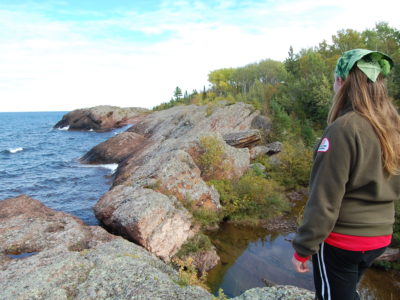
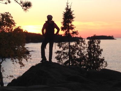
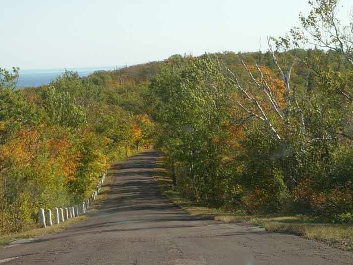
Easy hiking trails may be found alongside Lake Superior’s beckoning shore, while more demanding hikes are ever present on top of the ancient lava flows that majestically shape its coastline. Likewise one may take a more moderate walk into the thriving old-growth forest for a mile or two, or could seek a longer and more challenging route leading to the pristine tip of the peninsula or to the top of a bald mountain with a 360 degree panoramic view.

So Many Trails
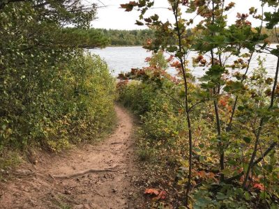
Copper Harbor is anchored by Fort Wilkins State Park to the east and Hunter’s Point Township Park to the west. Each is located about a mile outside of town, linked by crushed gravel trails that provide an easy hike to and from the village. Fort Wilkins State Park includes lovely trails that meander along the Lake Superior shoreline (including the Lighthouse Overlook) Lake Fanny Hooe and the Park’s interior. There are many parks and preserves in the area with beautiful hiking trails with various terrains.
The principal trailhead for Copper Harbor’s world-class mountain bike trails is located on the corner of Gratiot (US 41) and 2nd Street at the Donny Kilpela Memorial Park. While mountain biking is the most popular means to experience these human-powered trails, it’s important to note that hiking and trail running are also permitted. Most of these trails are multi-use, while some are biking only and others are hiking only and it’s helpful to pick up a Copper Harbor Trails Club Map before venturing out. The Copper Harbor Welcome Center is adjacent to this trailhead and is an excellent resource for more information and maps about the hiking opportunities in the region.
Unique Geology and Flora
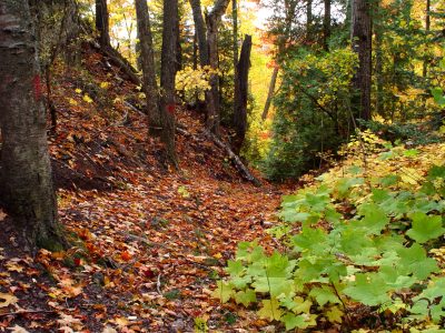
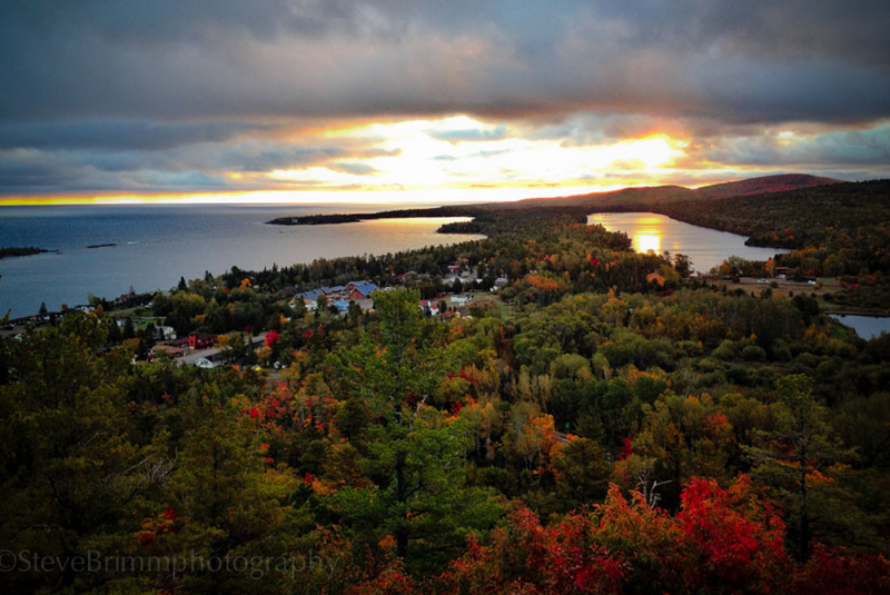
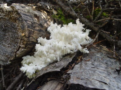
Whatever path you choose, hikers will encounter outcroppings of ancient volcanic rock piercing the landscape and punctuated with majestic coniferous and deciduous trees, lush carpets of moss, stunning patches of lichen and rich colonies of fungi. Gorgeous vista views of valleys and ridges are ample from Brockway Mountain, while multiple lookouts spanning out across Superior’s inland sea are plentiful, too.
Ultimately the unique Geoheritage & Geology of Copper Harbor presents such a varied landscape that one is provided with endless options to simply stroll about and take in the sights, or to lace up those hiking boots for a full day adventure. For those seeking a multi-day, wilderness backpacking experience, look no further than Isle Royale National Park with its 165 miles of hiking trails amidst dispersed primitive campsites on the uninhabited island.
Hiking Trails
Brockway Mountain
•Featuring the highest paved road between the Rockies and the Alleghenies, this drive to the top of Brockway Mountain is ten-miles long and includes many pull-offs enabling visitors to stop and take in the incredible scenery.

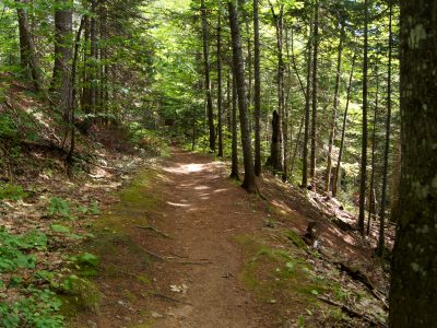
Copper Harbor Trails System
•Level: Moderate to Difficult
Nearly 40 miles of mix-use trails, the Copper Harbor Trails system features a diversity of hikes – from the rugged to the relaxed. Trail maps can be purchased at local businesses and the trailheads are located in downtown Copper Harbor at the Welcome Center and Trails End Campground. The trails are interlaced through the Keweenaw’s backcountry, a region that truly allows one to escape into a land that “time forgot.” Epic vistas, towering pines, babbling brooks and fantastic fungus abound in these enchanted forests. While almost all of this trail system is open to hikers (and some trails are hikers only), there are a hand-full of mountain bike/downhill-only trails that are too dangerous to share and must be avoided. Please read the signage at trail-heads and intersections for guidance. Learn more at Copper Harbor Trails Club


Estivant Pines
•Level: Moderate
This sanctuary, protected by the Michigan Nature Association, is one of the most popular hiking and snowshoeing in the Keweenaw. Located 2.5 miles south of Copper Harbor, this trail system is a great way to spend an afternoon. The trails consist of 2 loops; the Memorial and the Cathedral. Some of the trees are so big that 2 people can’t touch hands around one! There are numerous unusual plants and flowers as well as countless mushrooms to find. Pack a lunch and enjoy the grandeur and quiet of one of Michigan’s last stands of old growth white pine. Trails are narrow and hilly in spots and there are many roots to navigate.
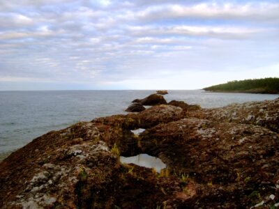


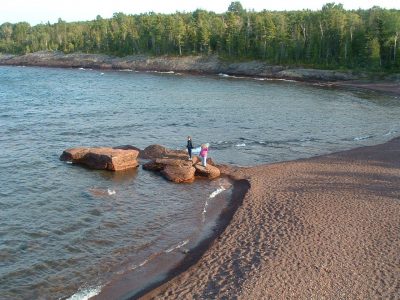
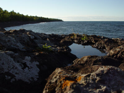
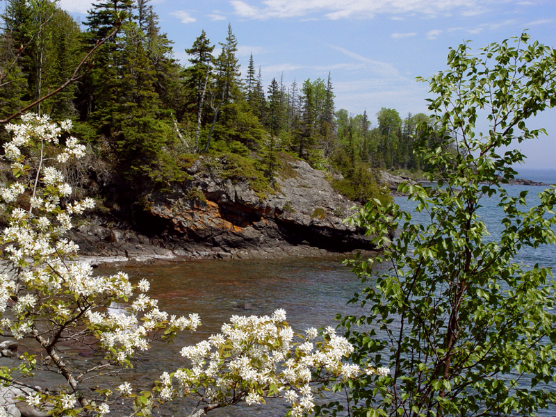
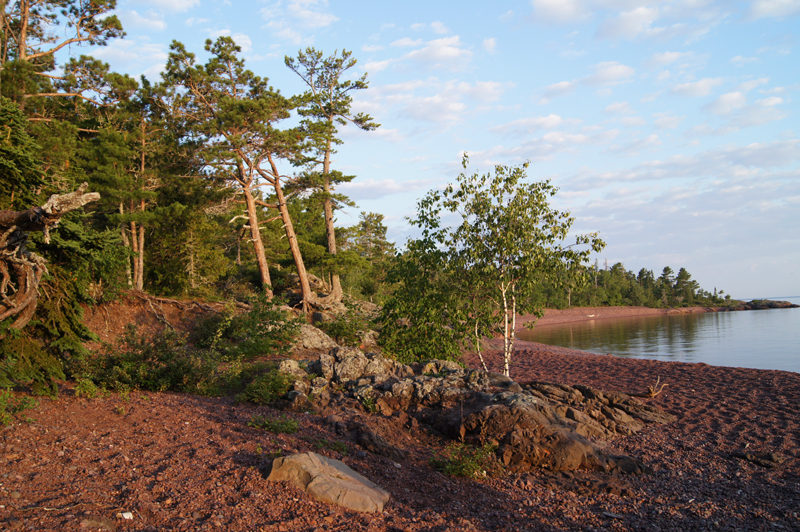
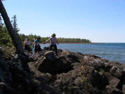
Horseshoe Harbor
•Level: Easy
This preserve, protected by the Nature Conservancy, is a beautiful and geologically interesting area. It is a short walk through the woods emerging along the Lake Superior shoreline. Horseshoe is located a couple miles east of Copper Harbor on the same shoreline. There is a large basalt outcropping that allows a great vista for viewing Lake Superior. The woodland birds are abundant with many nesting warblers and other songbirds. Bald eagles are often seen soaring along the shoreline while Common Loons pass by. In the evenings, enjoy the Hermit Thrush whose beautiful song can be heard nightly in summer.
Learn More: Mary McDonald Preserve at Horseshoe Harbor


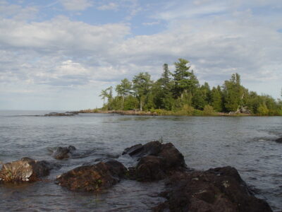
Hunter’s Point Park
•Level: Easy
An absolute favorite special spot in the area, Hunter’s Point is one of the few “flat” areas around and allows for an easy hike or snowshoe along both the Lake Superior and Harbor shores. There are 2 Trail-heads to Hunter’s Point Park. One is just left of the boat launch at the Copper Harbor Marina and the other is further west of the marina with signs leading the way down North Coast Shores Road, which will take you to a parking area and a handicap accessible viewing boardwalk.

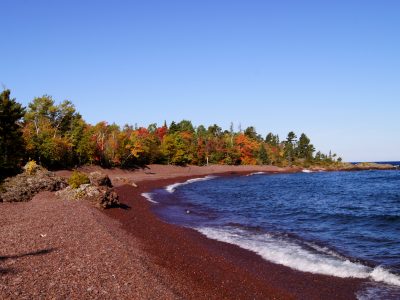
Lake Manganese
•Level: Easy
Located just a mile south of town, this pristine, tiny lake warms up quickly and hosts the only sand beach in immediate proximity to Copper Harbor. It’s great on a hot summer day for swimming amidst on and in water recreating. Picnic tables and pit toilets are available too.
There is a trail along the shore of the lake and depending on the lake level, goes around the lake. The habitat in this area makes for great bird and wildlife watching. Eagles fish, loons hunt and you may see otters dining on crayfish in the lake.
Note: parking space is limited.